Braemar Park – Bel Air Heights – Copeland Park
A larger area mixing detached houses with a third of homes in high-rise apartment buildings.
Braemar Park – Bel Air Heights – Copeland Park had 9,085 residents in 4,080 private dwellings in the 2021 census, via the Ottawa Neighbourhood Study. Population: 9,085 (2021).
Updated · Facts on this page link to their sources
About Braemar Park – Bel Air Heights – Copeland Park
Braemar Park – Bel Air Heights – Copeland Park had 9,085 residents in 4,080 private dwellings in the 2021 census, via the Ottawa Neighbourhood Study. Half of dwellings (49.5%) were single-detached houses and 32.7% were in apartment buildings of five or more storeys. Its Bike Score average of 79 is the joint highest of the twelve areas. Agincourt Road Public School is 0.3 km away and Iris Transitway station 1.3 km away, both in a straight line.
Boundaries
Ottawa Neighbourhood Study area 'Braemar Park - Bel Air Heights - Copeland Park'. ons-sqo.ca ons-sqo.ca
Homes
In the 2021 census, 49.5% of dwellings were single-detached houses, 32.7% were in apartment buildings of five or more storeys, 7.7% semi-detached and 5.6% row houses. Owner households were 61.4% and renter households 38.5%. The median owner-estimated value of owned dwellings was $600,000 (2021 census). ons-sqo.ca
- Population 9,085 (2021 census)
- Median owner-estimated dwelling value $600,000 (2021 census)
- Bike Score averages 79 (ONS data)
- Agincourt Road Public School (OCDSB) 0.3 km and Charlotte-Lemieux Public Elementary School (CÉPEO) 0.6 km away (straight line)
- Iris and Queensway South Transitway stations each 1.3 km away (straight line)
- J. A. Dulude Arena 1.5 km away (straight line)
Around Braemar Park – Bel Air Heights – Copeland Park
Walking rings at 5, 10 and 15 minutes from the neighbourhood centre.
Schools
10 nearbyAgincourt Road Public School
OCDSB1250 ch. Agincourt Rdmaps.ottawa.ca ocdsb.ca
280 m3 min walkJ. H. Putman Public School
OCDSB2051 Bel-Air Drivemaps.ottawa.ca ocdsb.ca
500 m6 min walkCharlotte-Lemieux Public Elementary School
CÉPEO2093 prom. Bel-Air Drmaps.ottawa.ca cepeo.on.ca
630 m8 min walkTorah Day School of Ottawa
Independent1119 rue Lazard Stmaps.ottawa.ca
700 m9 min walkMaryvale Academy
Independent2191 av. Benjamin Avemaps.ottawa.ca
1.0 km13 min walkOttawa Adventist School
Independent2191 av. Benjamin Avemaps.ottawa.ca
1.0 km13 min walkSt. Daniel School
OCSB1313 rue Field Stmaps.ottawa.ca ocsb.ca
1.0 km13 min walkD. Roy Kennedy Public School
OCDSB919 av. Woodroffe Avemaps.ottawa.ca ocdsb.ca
1.2 km15 min walkOttawa Jewish Community School
Independent31 Priv. Nadolny Sachs Privmaps.ottawa.ca
1.5 km18 min walkEdelweiss Private Academy
Independent31 privé Nadolny Sachs Privmaps.ottawa.ca
1.5 km19 min walk
Straight-line distances from the Braemar Park – Bel Air Heights – Copeland Park centre. Living near a school does not guarantee a place: confirm the designated school for an address with each board. All schools and board locators.
Parks & places
3 nearbyOutdoor rink, Agincourt Park
Outdoor rink (winter, weather permitting)
1269 Albany Dr.maps.ottawa.ca ottawa.ca
190 m2 min walkOutdoor rink, Kingsmere Park
Outdoor rink (winter, weather permitting)
2074 Benjamin Ave.maps.ottawa.ca ottawa.ca
700 m9 min walkOutdoor rink, Greenlawn Park
Outdoor rink (winter, weather permitting)
1145 Greenlawn Cres.maps.ottawa.ca ottawa.ca
960 m12 min walk
Shops & dining
9 nearbyPharmasave
Pharmacy
1366 Clyde Avenueopenstreetmap.org
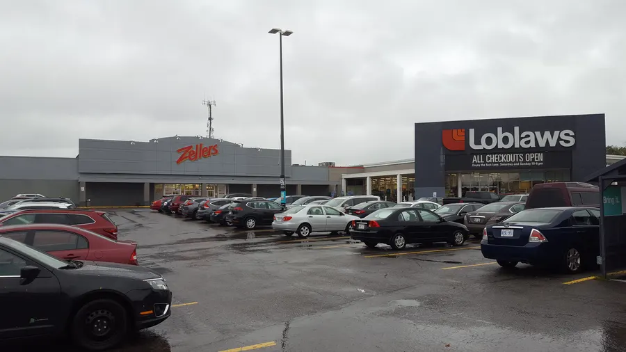
1.1 km14 min walkLoblaws
Supermarket
1980 Baseline Roadopenstreetmap.org
1.2 km15 min walkLoblaws Pharmacy
Pharmacy
1980 Baseline Roadopenstreetmap.org
1.2 km15 min walkRexall
Pharmacy
1363 Woodroffe Avenueopenstreetmap.org
1.3 km16 min walkWalmart Pharmacy
Pharmacy
1375 Baseline Roadopenstreetmap.org
1.3 km16 min walkMerivale Ideal Pharmacy
Pharmacy
1390 Clyde Avenueopenstreetmap.org
1.3 km16 min walkWalmart Supercentre
Supermarket
1375 Baseline Roadopenstreetmap.org
1.3 km16 min walkShoppers Drug Mart
Pharmacy
2148 Carling Avenueopenstreetmap.org
1.3 km17 min walkBulk Barn
Supermarket
2148 Carling Avenueopenstreetmap.org
1.4 km17 min walk
Getting around
TransitQueensway South station
Transitway / transit station (City of Ottawa transit stations layer)
openmaps.ottawa.ca
1.3 km17 min walkIris station
Transitway / transit station (City of Ottawa transit stations layer)
openmaps.ottawa.ca
1.3 km17 min walkQueensway North station
Transitway / transit station (City of Ottawa transit stations layer)
openmaps.ottawa.ca
1.4 km17 min walkBaseline station
Transitway / transit station (City of Ottawa transit stations layer)
openmaps.ottawa.ca
1.7 km21 min walkO-Train
Tunney's Pasture station is about 4.9 km away in a straight line (open; Line 1).
O-Train
Dow's Lake station is about 5.3 km away in a straight line (open; Line 2).
Transitway / bus
Queensway South station is about 1.3 km away in a straight line (open).
Downtown
Parliament Hill is about 8.0 km away in a straight line.
For sale in Braemar Park – Bel Air Heights – Copeland Park
No Braemar Park – Bel Air Heights – Copeland Park homes on nepean.homes right now
Selling here? Get a website for your home, or browse every home for sale in the area.


Quick answers
Short answers first; each links to the full answer and its sources.
What is Braemar Park – Bel Air Heights – Copeland Park like?
Braemar Park – Bel Air Heights – Copeland Park is a Nepean area of 9,085 residents (2021 census) with 49.5% single-detached homes and 32.7% of dwellings in apartment buildings of five or more storeys. The median owner-estimated dwelling value was $600,000 in 2021.
As of 2026-10 · ons-sqo.ca